
世界遺産“紀伊山地の霊場と参詣道” は2004年の指定と言うこと。道の世界遺産ということではキリスト教世界のスペイン、フランスにまたがる「サンティアゴ・デ・コンポステーラの巡礼路」と2つだけ。この楯ヶ崎は伊勢路の周辺に位置することになる。
自然造形はそれこそ熊野地域一帯にその美感を見せている。そういう美感の中にいると神がそこに宿っているとごく普通に感得するものなのだろうか。北海道の地に産まれ住んでいる身からすると、この近畿地方にこうした自然造形での感動地域が広く存在していることに新鮮なよろこびを感じる。古格をまとったはるかな先人と出会うようなちょっとうれしい感覚と言えるだろうか。
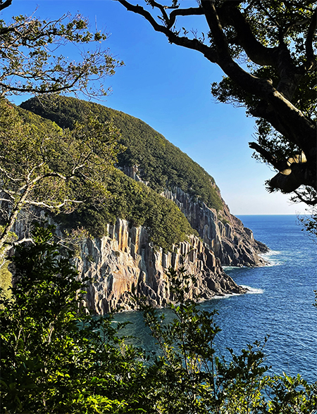
さてはじめて歩く楯ヶ崎への自然林道から、一瞬、木陰越に見えたのが上の写真。「おお、これが楯ヶ崎か、なぁ?」「すこし見え方、違うような?」と思ったけれど、その下の現地「案内図」分岐点からさらに上った尾根の位置からだったのでとっさには楯ヶ崎と思った。だけれども後で確認したら、どうも無名の崖面のよう。地図写真上にわたしが白い矢印を付けた楯ヶ崎のとなりの崖面。うーむ、紛らわしい(笑)。
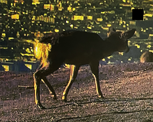
きのう、途中で出会ったシカのことを書いたけれど、きのうなにげにNHKの奈良に取材した歴史番組中に春日山のシカの画像があって、ついスマホを向けていた。楯ヶ崎への道中で出会ったシカさんの後ろ姿の様子とまったく同じような体勢だった。個人的な体験って少し美化されて印象に残っていくのだなぁと実感。シカさんへの愛情が強くなってきている。背景は奈良の市街地なのでその辺は大違いですが。おっと横道。
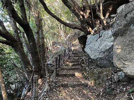
ときどき左手にチラチラと上の断崖が見え隠れするのですが、道は角度が振れていってやがて視界からは消えていくほどに林道を進まされる。「あれ、さっきの断崖良かったのに、どうなるのかなぁ」とやや混乱しながら先へ先へと、道はわたしに「引導を渡して」くる。う〜む、しょがない。
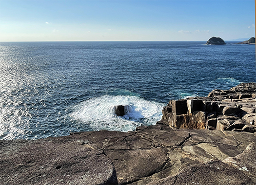
そんなわたしの不安な心理を見透かしたように、やがて一気に視界は広々とした太平洋の岸壁上に開放されていく。眼下には押し寄せる波が渦を巻いているような景観。
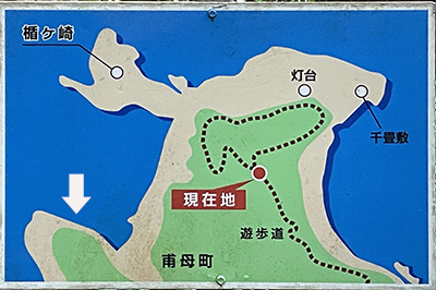
どうも手前側は地図で書かれている「千畳敷」の一部のようです。「灯台」は右手手前側に確認することができました。
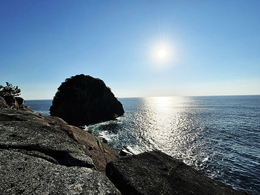
そうするとと視線を左手に向けたら、朝日を逆光に浴びながら、黒々とした「楯」状の岩塊が見えてきました。片道1.9kmと言いながら、アップダウンといろいろな風景景観を目に焼き付けさせられた末の目的地であります。ふ〜、ずいぶんと迷わせられたけれど、見ていた写真通りの外観形状。しかしこの時期の朝にはここまで逆光になってしまうのかと、ここまで来てようやく「誰もいない」理由がわかった(笑)。
でもまぁそんな繰り言は、きれいさっぱり汗がひいていくように消えていった。
English version⬇
Encountering the Unusual Nature “Alone”: Imperial Mythology and Kumano Journey-7
During this early morning visit to Tategasaki, I did not encounter any human beings. The journey where the inner world encounters all the phenomena of nature with its bare skin. …
The World Heritage Site “Sacred Sites and Pilgrimage Routes in the Kii Mountain Range” was designated in 2004. There are only two World Heritage sites along the road: the pilgrimage route of Santiago de Compostela in Spain and France, which straddle the border between the Christian world. Tategasaki is located on the periphery of the Ise Road.
The natural formations show their beauty all over the Kumano area. When you are in the midst of such beauty, it is quite normal to feel that God resides there. As someone who was born and lives in Hokkaido, I feel a fresh sense of joy at the fact that there is such a wide area of inspiring natural formations in the Kinki region. I guess you could say that it is a little like meeting a distant predecessor clad in ancient dignity.
From the natural forest road to Tategasaki, which I walked for the first time, I saw the photo above for a moment over the shade of the trees. “Oh, is this Tategasaki? It looks a little different, doesn’t it? I thought it was Tategasaki, but it was located on the ridge further up from the junction of the local “guide map” below, so I immediately thought it was Tategasaki. However, when I checked later, it seemed to be an unnamed cliff face. The cliff face next to Tategasaki, which I marked with a white arrow on the map. Hmmm, it is confusing (laugh).
Yesterday, I wrote about the deer we met on the way to Tategasaki, but yesterday I saw an image of deer in Kasuga-yama in NHK’s history program on Nara, and I couldn’t help pointing my phone at it. The deer we met on the way to Tategasaki was in the exact same posture as the deer we saw on the road to Tategasaki. I realized that personal experiences are a bit beautified and leave a lasting impression. My affection for the deer is getting stronger. The background is the urban area of Nara, though, so there is a big difference in that area. Oops, a side road.
Sometimes I would glimpse the cliff above me on my left, but the road would swing in an angle and eventually disappear from view as I was forced to continue on through the woods. I was a little confused, wondering what was going to happen to the cliff that was so nice earlier, but the road kept “leading” me onward. I was wondering what was going to happen to me.
As if seeing through my anxious state of mind, my view was soon opened up to the wide expanse of the Pacific Ocean. Below me, the view is like a whirlpool of surging waves.
Apparently, the foreground is part of the “Senjojiki,” as described on the map. The “lighthouse” could be seen on the front right.
Then I turned my gaze to the left and saw a dark “shield” shaped mass of rock backlit by the morning sun. Although it was only 1.9 km one way, this was our destination after having our eyes burned by the ups and downs and the various landscapes. Well, we got lost for a long time, but the exterior shape was just as I had seen it in the pictures. However, I finally understood the reason why there was no one here, as I wondered if it would be so backlit in the morning at this time of the year (laugh).
But, well, that kind of nonsense disappeared as if I was sweating.
共有:

Posted on 1月 8th, 2024 by 三木 奎吾
Filed under: 未分類


コメントを投稿
「※誹謗中傷や、悪意のある書き込み、営利目的などのコメントを防ぐために、投稿された全てのコメントは一時的に保留されますのでご了承ください。」
You must be logged in to post a comment.