

近代国家にとってその領土の地理を把握することは、統治の正当性を担保する重要な基盤情報。正確な地理認識がなければ、権力行使の総合的実効性があり得ない。国土領域の防衛についてもその交通についても、さらに産業育成、国民の人口増加、定住の推進確保などの「国土支配」の基礎になる。
そういった「民政」への統治実績こそが近代国家概念そのものであるという国際常識に対して、日本の江戸幕府は非常に正しい認識を持って対処していたといえる。
江戸幕府体制は領土確定の基礎としていち早く北海道島の測量を推進し、その後、ロシアとの国境紛争に備えて、樺太、千島列島などの探査を進めていた。
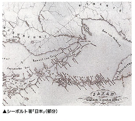
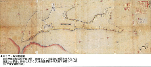
間宮林蔵はこの樺太の測量に於いて国家的な巨大な貢献を果たした。樺太と北東アジア大陸が地続きではなく、島嶼であることを国際的に確定させたことで、世界地図情報にも画期をもたらせた。「国家的特殊任務」としてそれらは遂行され、江戸幕府の鎖国方針のなかでそれらは「国家機密」ともされていた。幕府としてはオランダ人医師シーボルトに対してのこの国家機密「漏洩」事件に際して、日本側情報提供者に極刑を科し、シーボルトに対しては国外退去させた。
しかしいちばん上のような地図情報がシーボルトによって欧米世界に情報共有されることで、日本の政体機構がこのような正確な情報に対しリスペクトする近代国家としての基本要件を持っていると認識されていった。このことは当時の国益にとって非常に効果があったのだと思える。少なくとも情報についての日露「戦争」において欧米が日本に優位性を認めたひとつの根拠となったのだろう。たぶん他のアジア諸国とは違う近代国家の基本資格を日本は持っていると認識した。日本は独立国家たることを死守できたのだ。江戸幕府と北辺領土探検者たちの「国家情報力」の営為が明治以降の日本を救ったといえるのだろう。
司馬遼太郎が繰り返し、日露戦争に至るこの時代の日本人について探究したことには、こういった背景へのリスペクトがあったのだと思っています。
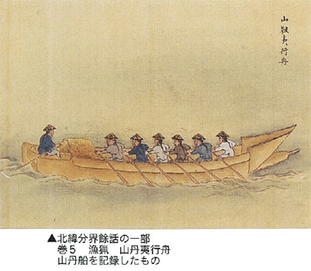
間宮海峡を発見してのち、間宮林蔵は樺太が向き合うアジア大陸北東端地域、黒竜江の河口地域に対しての「北方外交」にも取り組んでいく。樺太地域在住の地域住民を組織して海峡を越えて、それまで「山丹」と呼ばれたり「韃靼」と呼称されていた河口・流域地域を黒竜江を遡って探査する。
日本の歴史記録ではこれら地域との直接交渉の記録に乏しい。かろうじて奥州藤原氏以前の安倍氏支配時代に、その当主家系が訪問したという断片記録に触れた程度。ただ、ながく日本中央権力地域との「交易」関係で奥州地域が特異な地位を占めていたのには、こうした北辺地域との交流が基礎にあったのに違いない。間宮林蔵の外交には、これらの地域とのかかわりを再認識させた側面もあったことだろう。
English version⬇
Hokkaido and Sakhalin further to the Heilongjiang River estuary area – Mamiya Rinzo’s birthplace – 7
The scientific rationality of territorial grasp and geographical recognition was established as the basis for territorial domination of the northern part of Japan. From this achievement, Mamiya Rinzo further advanced into northern diplomacy. …
For a modern state, understanding the geography of its territory is important fundamental information that ensures the legitimacy of its governance. Without accurate geographical awareness, the overall effectiveness of the exercise of power is impossible. It is the basis for “land rule,” including the defense of the territory and its transportation, as well as the development of industry, population growth, and the promotion and securing of settlement.
It can be said that Japan’s Edo shogunate had a very correct understanding of the international common sense that such “civil administration” is the very essence of the modern concept of the state.
The Edo shogunate system was quick to promote the surveying of Hokkaido Island as the basis for territorial determination, and later, in preparation for border disputes with Russia, it promoted exploration of Sakhalin Island, the Kuril Islands, and other areas.
Rinzo Mamiya made a huge national contribution in this survey of Sakhalin. He established internationally that Sakhalin and the continent of Northeast Asia were not connected to the land, but were islands, and this led to a breakthrough in world map information. The “special national missions” were carried out and were considered “state secrets” under the Edo Shogunate’s policy of national seclusion. In the case of the “leak” of state secrets to the Dutch physician Siebold, the Shogunate imposed a maximum penalty on the Japanese informant and had Siebold deported from Japan.
However, as the above map information was shared with the Western world by Siebold, it was recognized that Japan’s political structure had the basic requirements of a modern nation that respected such accurate information. This was very effective for the national interest at the time. At the very least, it was one of the grounds for the West to recognize Japan’s superiority in the Russo-Japanese “war” regarding information. Perhaps it was the recognition that Japan possessed the basic qualifications of a modern nation, different from other Asian nations. Japan could defend its independence to the death. It can be said that the efforts of the Edo shogunate and the explorers of the Northern Territories in the “national intelligence power” saved Japan from the Meiji era onward.
I believe that Ryotaro Shiba’s repeated exploration of the Japanese in this period leading up to the Russo-Japanese War was based on his respect for this kind of background.
After discovering the Mamiya Strait, Mamiya Rinzo also engaged in “northern diplomacy” toward the region at the mouth of the Heilongjiang River, the northeastern tip of the Asian continent that Karafuto faced. He organized local residents living in the Sakhalin region to cross the strait and explore the estuary and basin areas of the Heilongjiang River, which had previously been called “Shantan” or “Tadatoku.
Japanese historical records are scant on direct negotiations with these regions. There is barely a fragmentary record of a visit by a family member of the head of the Abe clan during the period of Abe rule before the Oshu Fujiwara clan. However, the fact that the Oshu region occupied a unique position in “trade” with the central power regions of Japan for a long time must have been based on such exchanges with the northern regions. Mamiya Rinzo’s diplomacy must have had some aspect of reaffirming the relationship with these regions.
Posted on 5月 22nd, 2023 by 三木 奎吾
Filed under: 歴史探訪


コメントを投稿
「※誹謗中傷や、悪意のある書き込み、営利目的などのコメントを防ぐために、投稿された全てのコメントは一時的に保留されますのでご了承ください。」
You must be logged in to post a comment.