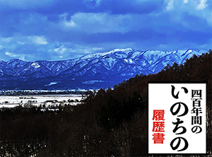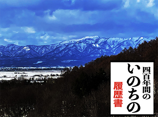
ドラえもん的なタイムマシン家系探訪、時代は1603年から1650年、さらに1600年代後期へとさかのぼってくる。今(2026年)から423年の過ぎ去りし過去。
1603年に芸州(広島)浅野藩が関ヶ原合戦後の恩賞で紀州から移封した当時、ときを同じくしてわたしの家系は芸州「入野」地域に入植している。家系の当時の苗字は「原氏」。家系伝承を伝える書物では「紀州で仕官」していたが「故有りて」土地に根ざす土豪層の立場でこの地に入植と。
そこからすぐに入野村の庄屋を務めている。武家として仕官の立場からすぐに入植地で庄屋になる流れは、その入植自体が地域権力機構との強い紐帯・連携を想起させる。そこから3代の代替わりを経て「九世の祖」である先祖は、周辺地域の庄屋層を連合的に束ね統括する「所務役」という芸州藩地方支配機構の重要な役割を担うようになっている。苗字帯刀を許される特権層。
管理する領地の当時の総石高は9,615石。1万石で「大名」となる社会でこの規模の地域支配役。武家支配社会で経済・農業生産を管理遂行する役とは、心臓部的な社会的役務だろう。
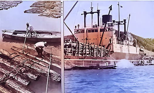
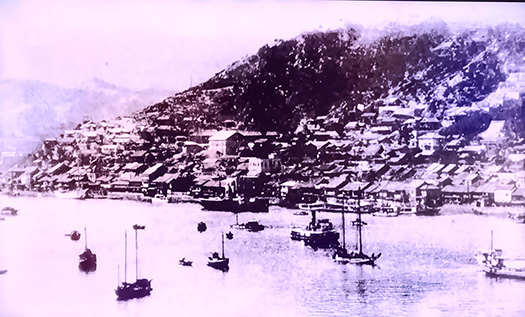
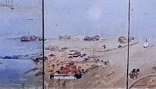
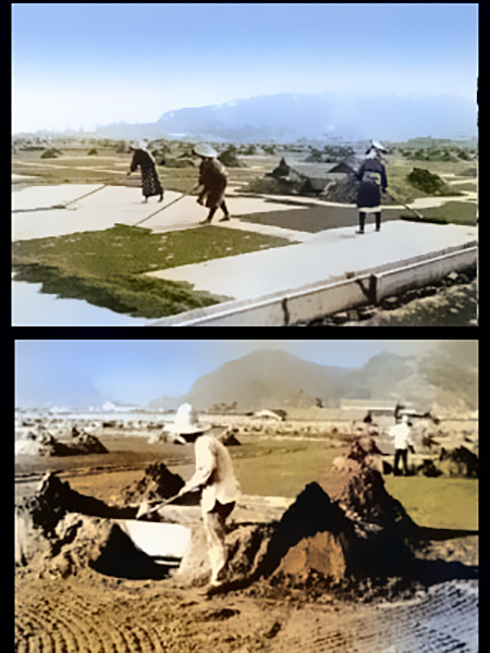
そしてこの「管理地」のなかに現在の竹原市(当時は吉名村・木谷村)の塩浜・塩田が含まれていた。
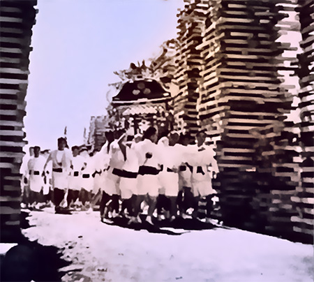
この塩浜では兵庫県の赤穂藩が取り入れて最新技術であった「入浜式塩田」が1650年に導入されたことが歴史的に明らかになった。そこから交易港・尾道で商家「竹原屋」が成立し、竹原の塩は一種ブランド化されていった。信州では北前交易で塩が到着すると「竹原が来た」と喜んだ伝承が伝えられている。
・・・なにやら、先日まで深掘りしていた「松永の塩」との連想が強く働いてくる。
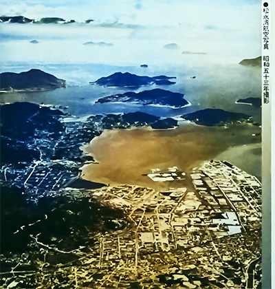
松永では地域権力・福山藩が塩田テクノラート(本庄重正)をスカウトして開発したが、故あってわたしの家系はそこで「塩浜づくり」していた伝承記録。松永では先行の成功例としてこの竹原の塩田経営が手本とされ、家系はその経済文化を背に負って松永・今津に移動してきた蓋然性は非常に高い。
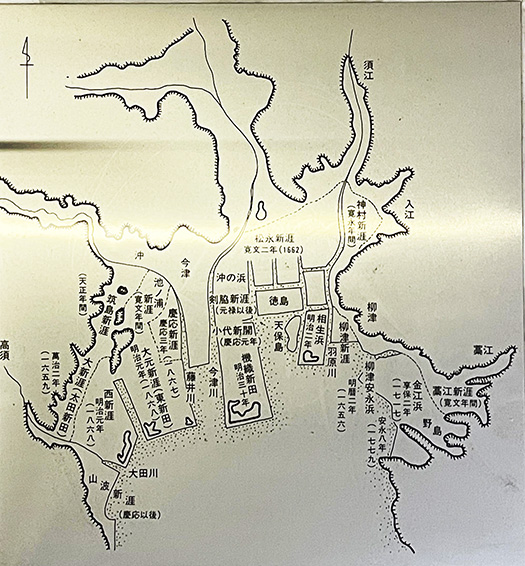
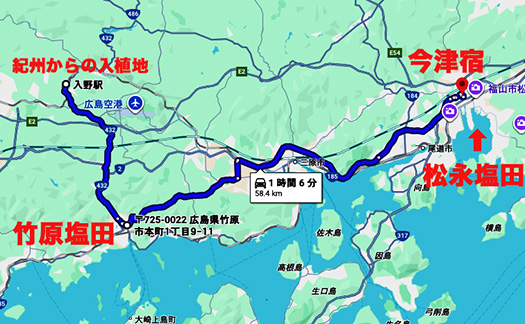
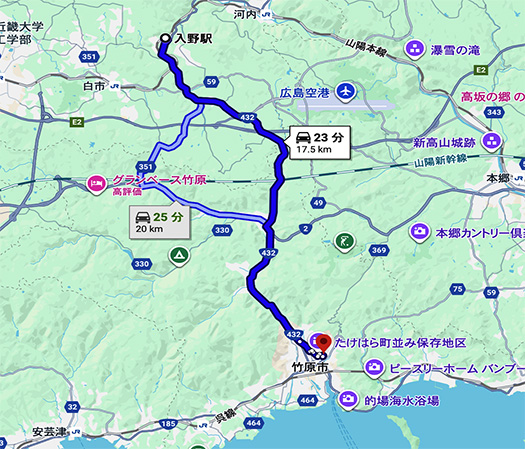
上の地図は現代のものだが江戸期のルートに沿っている。入植した入野から竹原までは17km。そこから松永の塩田を見晴らして家系の痕跡が色濃い「今津宿」まで約40km。
距離的にも経済活動情報の伝達範囲として非常に妥当性が高い。
1600年代初期から、その後の家系の事跡・証拠がたくさん残る1730年ころまでの「ミッシングリンク」が非常に整合的に見えてきた。さらに深掘りしていきたい。
●お知らせ
拙書「作家と住空間」幻冬舎から電子書籍で発刊
お求めはAmazonで。
https://amzn.asia/d/eUiv9yO
English version⬇
【Development of Takahara Salt Fields: Administrative Land Managed by “Tokumiyaku” Officials After 1603 Settlement】
The lineage’s footprints remain unbroken until the early Edo period. Economic structures linking Takahara to Matsunaga and further to Onomichi through salt fields. Visualizing the missing link. …
A Doraemon-esque time machine journey through my family lineage, tracing back to the era spanning 1603 to 1650, and further into the late 1600s. A past now 423 years removed from the present (2026).
In 1603, when the Asano clan of Geishu (Hiroshima) was transferred from Kishu as a reward after the Battle of Sekigahara, my family settled in the “Iri no” region of Geishu at the same time. The family surname at that time was “Hara”. According to family tradition records, they had been “serving as retainers in Kishu” but “due to certain circumstances” settled here as local landowners rooted in the land.
Immediately thereafter, they served as village headmen (shoya) in Irino Village. This progression from samurai retainers to village headmen in the settlement suggests the settlement itself involved strong ties and collaboration with the local power structure. After three generations, the ancestor who was the “9th generation progenitor” assumed the crucial role of “Sokumiyaku” within the local governance structure of the Geishu Domain. This position involved uniting and overseeing the village headmen of the surrounding areas. They were a privileged class permitted to bear a surname and wear swords.
The total kokudaka (land yield) of the managed territory at that time was 9,615 koku. In a society where 10,000 koku defined a “daimyo,” this represented a significant scale of regional governance. In a samurai-dominated society, managing and executing economic and agricultural production was a core social function.
Within this “managed territory” lay the salt ponds and salt fields of what is now Takehara City (then Yoshina Village and Kitanimura).
It became clear that the “inlet-style salt fields”—a cutting-edge technique introduced in 1650 by the Akō Domain of Hyōgo Prefecture—were adopted at these salt ponds. From there, the merchant house “Takeharaya” was established in the trading port of Onomichi, and Takehara salt gradually became a kind of brand. In Shinshu, there is a tradition that when salt arrived via the Kitamae trade, people rejoiced, saying, “Takehara has come!”
…Somehow, strong associations with “Matsunaga Salt,” which I had been researching deeply until recently, come to mind.
In Matsunaga, the regional power, Fukuyama Domain, recruited a salt field technocrat (Honjo Shigemasa) for development. Due to certain circumstances, my family lineage has records of “salt beach construction” there. Matsunaga likely used this earlier successful example of Takahara’s salt field management as a model. My family lineage, carrying that economic and cultural heritage, moved to Matsunaga and Imazu. The probability of this is very high.
The map above is modern but follows the Edo-period route. From the settlement at Irino to Takehara is 17km. From there, looking out over the Matsunaga salt fields, it’s about 40km to “Imazu-juku,” where traces of the family lineage are particularly strong.
Distant-wise, it’s also highly plausible as a range for transmitting economic activity information.
The “missing link” from the early 1600s to around 1730, when abundant evidence of the family’s subsequent activities remains, now appears highly coherent. I wish to delve deeper.
●Notice
My book “Writers and Living Spaces” published as an e-book by Gentosha
Available on Amazon.
共有:

Posted on 1月 5th, 2026 by 三木 奎吾
Filed under: 未分類 | No Comments »